Wayfinding and Transit Maps
Thiruvananthapuram
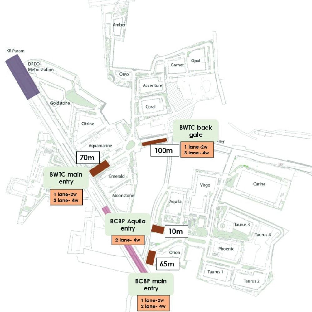
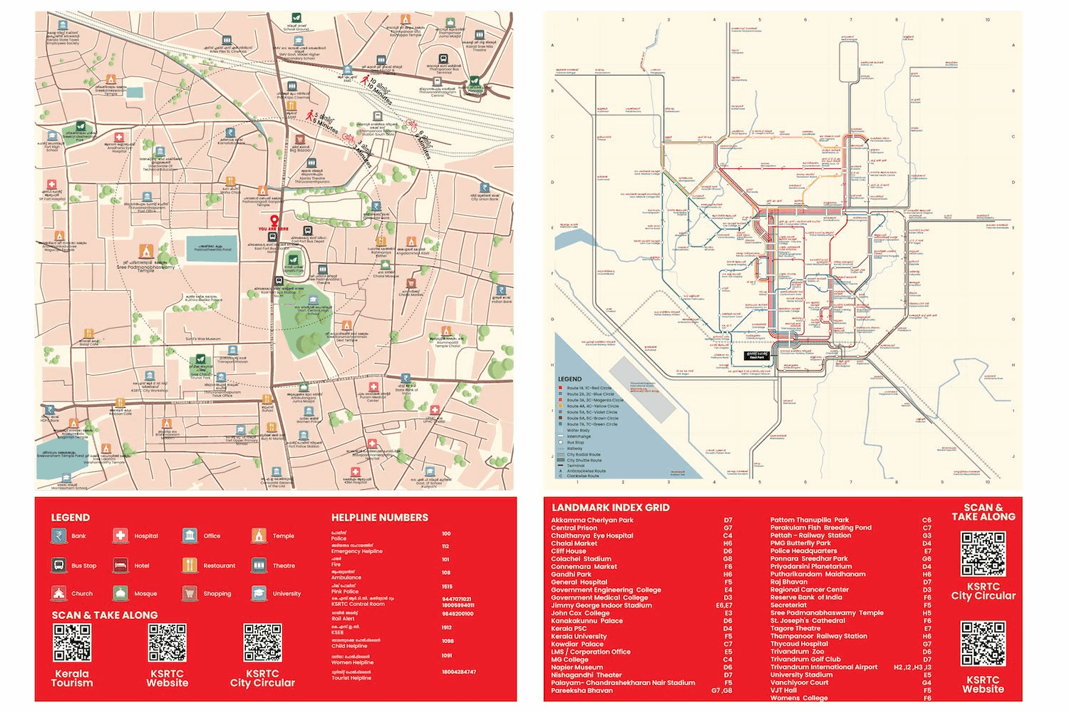
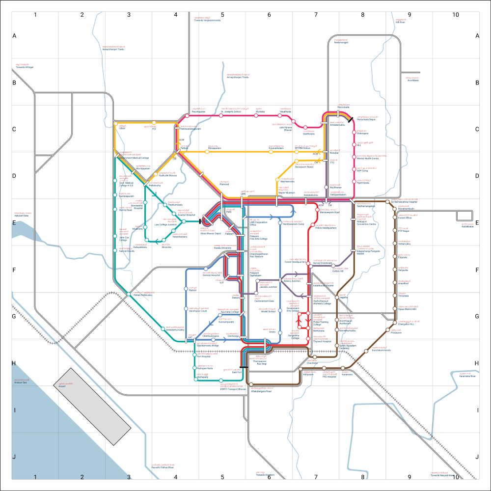
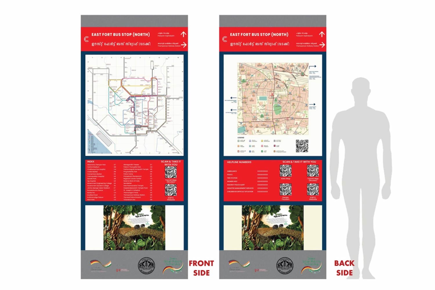
Moving around a city should be easy, clear, and intuitive. Under the GIZ SMART-SUT initiative, The Urban Lab is helping Thiruvananthapuram become a more walkable, commuter-friendly city by designing a clear and accessible wayfinding system for its streets and public transport.
Through on-ground studies, stakeholder discussions, and design prototyping, we are developing a consistent signage and mapping system that helps people confidently navigate the city by foot and by bus. By improving the way people find their way, we are making public spaces in Trivandrum more welcoming and supporting a shift towards sustainable, people-centered urban mobility.
Services
Movement pattern studies
Stakeholder engagement
Citywide signage and wayfinding strategy
Visual language and graphic system design
Signage prototyping for pedestrian and transit nodes
Pilot installations at transport interchanges
Wayfinding manual and toolkit development
Technical presentations and stakeholder workshops
Client
Deutsche Gesellschaft für Internationale Zusammenarbeit (GIZ)
Period
September 2021 to August 2024
![]()
![]()