Kochi Local Connectivity Map
Kochi
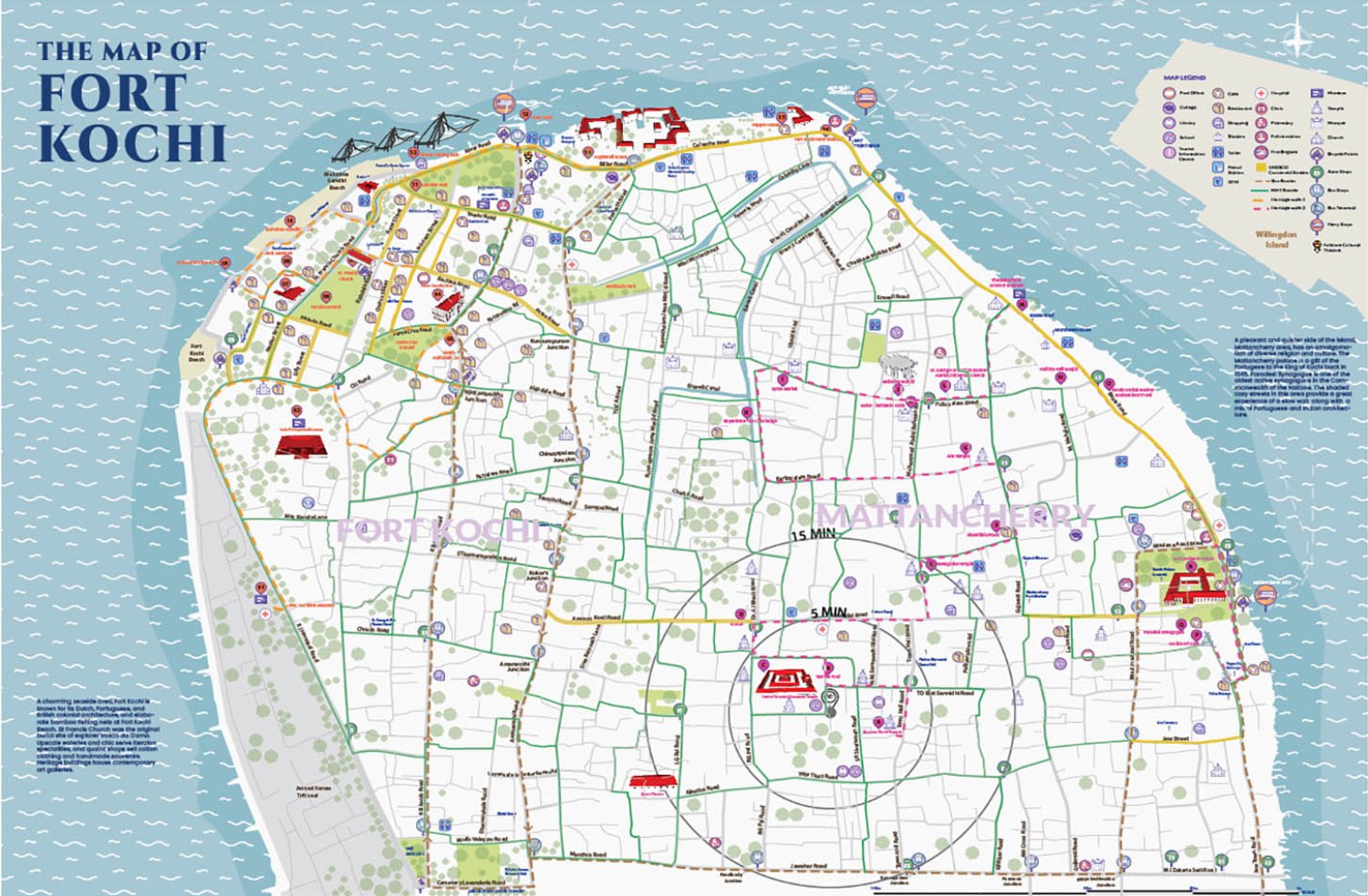
Kochi Municipal Corporation (KMC), supported by Deutsche Gesellschaft für Internationale Zusammenarbeit GIZ) nder the SMART-SUT project, is developing a Transport Strategy Document (TSD) on ‘Seamless and inclusive mobility in Fort Kochi Island. TSD documents contain existing policies and projects related to urban transport and identifies and analyses the problems and challenges. The city recognized the need for a ‘Local Connectivity Map’ under the subject ‘Signage and Wayfinding’ of the TSD.
The Urban Lab is helping KMC to prepare a Local Connectivity Map, including designs for assembly and erection. The Local Connectivity Map would have local information put together on a map, which would help users to identify their destinations and navigate easily. The scope includes a graphical design and presentation of an A0 sized map with local information, heritage and cuisine routes, and tourist landmarks in the FKM area. The scope also includes designing a structure where these maps can be installed with additional space for advertisements.
Services
Graphic Design
Product Design
Stakeholder Consultation
Clients
GFA Consulting Group
Period
Feb 2019 – Nov 2020